In today's digital age, easy access to technological tools has transformed several areas of activity, including the land and area measurement segment. The availability of free applications that offer this service with precision and efficiency has revolutionized the way professionals and amateurs deal with the dimensioning of physical spaces. These tools are particularly useful for surveyors, architects, builders and even for those who simply want to plan a garden or home renovation.
While choosing the right app can seem daunting due to the variety of options available, it’s important to consider the features each one offers to ensure they meet your specific needs. This article aims to carefully select the best free land and area measurement apps, highlighting their main features and functionalities to help you make your choice.
Exploring the Functionality of Measurement Applications
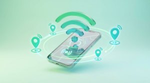
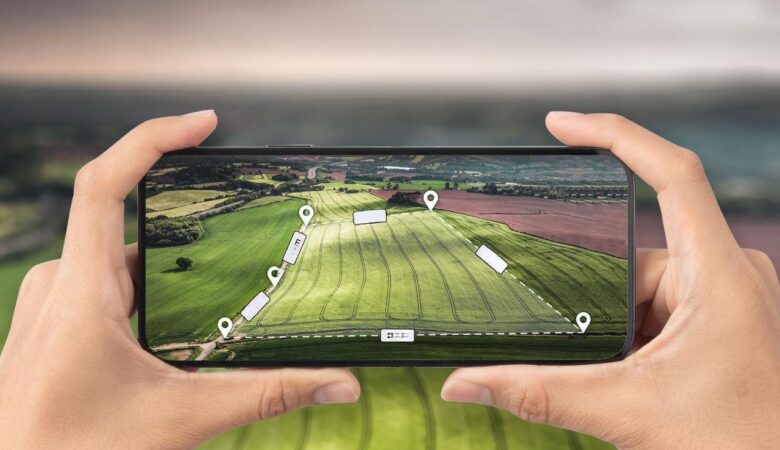
Before we dive into the list of the best apps, it is essential to understand that these software uses GPS technology or interactive maps to accurately calculate areas and perimeters. They are specially designed to be easy to use, even for those without advanced technical experience. Now, let’s explore some of the best options available on the market.
Google Earth
Google Earth is one of the most versatile and widely used applications for measuring areas. With the ability to visualize any location in the world through... satellite images, This application allows users to measure land and areas in a practical way. Furthermore, its user-friendly interface and the ability to save projects and share them with others make Google Earth an indispensable tool for professionals and enthusiasts of spatial planning.
Additionally, Google Earth offers advanced features such as 3D terrain visualization and the creation of paths and markers, which make it easier to interpret and plan large projects. Its frequent updates ensure that users have access to the most recent and accurate information available.
GPS Fields Area Measure
When it comes to simplicity and effectiveness, GPS Fields Area Measure stands out as an excellent option. This free app allows users to measure land using their device’s GPS to ensure accurate measurements in real time. It is ideal for farmers, builders, and real estate agents who need a reliable tool for quick and accurate measurements.
This application also offers the option to save measurements, share results with other devices and even export data to file formats such as CSV and KML, which provides great flexibility and adaptability for various professional projects.
Land Calculator: Survey Area, Perimeter, Distance
Land Calculator is an extremely useful tool for those who need to calculate areas, perimeters and distances quickly and efficiently. With a clean and intuitive interface, this application makes it easy to enter data and view results, making it ideal for use in the field or in an office environment.
Additionally, Land Calculator supports a variety of measurement units, which is a significant advantage for international users. The ability to export data is also present, providing easy integration with other planning and mapping software.
Map Pad GPS Land Surveys & Measurements
Map Pad is another robust application aimed at professionals who need an accurate tool for land measurements. It offers not only basic measurement functionality but also advanced features like point, line, and polygon mapping. This makes it a popular choice among engineers and architects who need extensive technical details.
This application also allows users to export their data in various formats, including PDF and DXF, facilitating communication and project documentation. Its ability to work with... offline maps It's a major advantage, especially in remote locations where internet connectivity is unreliable.
Measure Map Lite
Finally, Measure Map Lite offers a practical and effective solution for measuring large areas. It uses satellite imagery to allow users to draw directly on the map, making it easy to define specific areas for measurement. Accuracy and ease of use are strong points of this app, which is suitable for both professionals and amateurs.
This application also has a Pro version, which unlocks advanced features and offers greater accuracy and customization options, suitable for more complex and demanding projects.
Additional Features
In addition to the basic area and perimeter measurement functionality, many of these apps offer additional features that can be extremely useful. For example, some include the ability to add annotations and photos to maps, which can be vital for project documentation. Others allow integration with external measuring devices, increasing the accuracy of measurements.
FAQ sobre Aplicativos de Medição de Terrenos
Q: Are land measurement apps accurate? A: Yes, many of these apps use GPS or satellite data to provide accurate measurements. However, accuracy may vary depending on the technology used and local conditions.
Q: Can I use these apps for professional measurements? A: Many of these apps are suitable for professional use, but it's important to check that they meet the specific standards and requirements of your field of work.
Q: Do these apps work without internet access? A: Some apps offer offline functionality, but it's best to check the specifications of each one to ensure they meet your needs in environments without an internet connection.
What changes between measuring by walking and measuring by map?
There are two methods behind these apps, and they have different levels of accuracy. In the first, you walk the perimeter with your phone in your pocket, and the GPS records the points along the way. In the second, you mark the vertices on the satellite image without moving from your spot.
Walking yields better results on terrain with obstacles and vegetation, but inherits the error of civilian GPS, which tends to be off by a few meters in open areas and worsens considerably near high walls, dense forest, and slopes. Marking on a map is faster, but depends on the satellite image being up-to-date and aligned—old photos no longer show fences that have moved.
In practice, the larger the area, the smaller the relative weight of the error. A deviation of three meters on a small plot greatly distorts the number; on the same plot with several hectares, it almost disappears in the total.
The limit that no one can ignore: this has no legal value.
Measurements taken via cell phone are useful for estimation, planning, and communication. It does not replace topographic surveying. and does not generate a document valid for property registration, subdivision, regularization, legal proceedings, or boundary disputes with neighbors.
For this purpose, there is the survey carried out by a qualified professional, with precision equipment and registered technical responsibility. Demarcating rural property boundaries in Brazil involves georeferencing with its own specific standards and accreditation with the competent authority—something that no free app provides.
Use the phone number to find out how much grass to buy, estimate fencing, plan planting, or get an idea of the size before visiting a plot of land. For any decision involving large sums of money or legal consequences, a professional survey is the way to go.
How to take the best possible measurement in practice.
- 1. Leave the GPS active for a few minutes before starting, so the device can detect more satellites.
- 2. Activate the system's location precision, which uses Wi-Fi and sensors to improve location accuracy.
- 3. Walk close to the boundary, at a steady pace, without cutting across corners.
- 4. Close the polygon at the same point where you started and check if the line drawn on the map matches the actual terrain.
- 5. Repeat the measurement on another day and at another time and compare the two results: the difference between them is your margin of error.
- 6. Export the polygon file, if the application allows it, so you don't lose your work.
Before installing, check the essentials for the category: location permission only during use, offline map functionality for areas without signal, number of full-screen ads during measurement, and whether the app requires creating an account to save your data.
Common mistakes, native features, and frequently asked questions.
The most frequent pitfalls are measuring with a shaking cell phone in hand, starting before the GPS stabilizes, confusing units — hectares, acre, and square meters coexist in the same country with very different values — and accepting the first number without repeating the measurement.
Out of the box, the phone already helps with two things. The system compass shows orientation and, on the iPhone, also the coordinates of your current location. The map applications installed by default allow you to measure distances between points and, in some versions, calculate the area of a simple polygon directly in the phone's browser, without installing anything.
Funciona sem internet?
The GPS works without mobile data, but the background map needs to have been downloaded beforehand. Without it, you're measuring blindly.
Qual a margem de erro esperada?
Under good conditions, the deviation is a few meters in the positioning of each point. In an area surrounded by trees, a wall, or steep terrain, the deviation increases and the polygon becomes distorted.
Serve para acertar a divisa com o vizinho?
No. Border disputes are resolved with documentation and technical surveys. Using a messaging app number in this conversation usually generates more conflict than it solves.
Conclusion
Choosing a free land and area measurement app depends on your specific needs, whether for personal or professional use. With the variety of options available, you can find a tool that not only meets your expectations in terms of functionality and accuracy, but also improves your efficiency in any land measurement project. Try out the listed options and find out which one best suits your land measurement and spatial planning needs.